|
News Code
98135
Copied
PrecisionHawk reveals Phase I Pathfinder results on drone operations
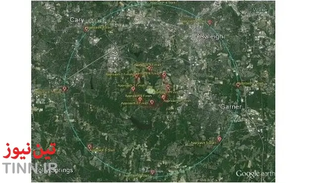
TIN news: US-based drone data and safety company PrecisionHawk has released results for the Phase I Pathfinder programme as part of the White House Office of Science and Technology Policy (OSTP) workshop on drones and the future of aviation.
The study result, which has been included in the White House OSTP Fact Sheet, determines the boundaries and conditions of extended visual line of sight (EVLOS) operations for pilots.
The new report quantifies the EVLOS distance at two to three nautical miles for non-technology assisted unmanned aircraft system (UAS) operations.
US chief technology officer Megan Smith said: “Innovative commercial and government platforms and applications for UAS are helping to solve problems, save money, conserve critical resources, and even save lives.
As a US Federal Aviation Administration (FAA)-led initiative, the Pathfinder programme enables the early introduction of low-altitude operations for small UAS into the National Airspace System.
The study result, which has been included in the White House OSTP Fact Sheet, determines the boundaries and conditions of extended visual line of sight (EVLOS) operations for pilots.
The new report quantifies the EVLOS distance at two to three nautical miles for non-technology assisted unmanned aircraft system (UAS) operations.
US chief technology officer Megan Smith said: “Innovative commercial and government platforms and applications for UAS are helping to solve problems, save money, conserve critical resources, and even save lives.
As a US Federal Aviation Administration (FAA)-led initiative, the Pathfinder programme enables the early introduction of low-altitude operations for small UAS into the National Airspace System.
"We look forward to continuing our work with the FAA in examining the safest ways to integrate drones as efficient business tools across industries."
PrecisionHawk executive vice-president Thomas Haun said: “We look forward to continuing our work with the FAA in examining the safest ways to integrate drones as efficient business tools across industries.”
In May, PrecisionHawk was chosen as a Pathfinder, while the Phase I findings reveal the results obtained from a series of EVLOS tests conducted in December 2015 at Lake Wheeler, North Carolina, US.
The several EVLOS-dependent uses for UAS include monitoring of wildlife and emergency situations, field safety and enhanced agricultural survey for improved field data and resource management.
The White House OSTP Fact Sheet includes the current Pathfinder results and PrecisionHawk's new software tool DataMapper InFlight, which allows remote operators to capture images within a specific area.
In May, PrecisionHawk was chosen as a Pathfinder, while the Phase I findings reveal the results obtained from a series of EVLOS tests conducted in December 2015 at Lake Wheeler, North Carolina, US.
The several EVLOS-dependent uses for UAS include monitoring of wildlife and emergency situations, field safety and enhanced agricultural survey for improved field data and resource management.
The White House OSTP Fact Sheet includes the current Pathfinder results and PrecisionHawk's new software tool DataMapper InFlight, which allows remote operators to capture images within a specific area.