|
News Code
31189
Copied
Libyas Maitiga air base attacked by unidentified jet
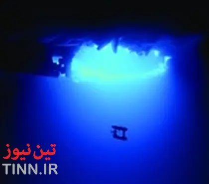
TIN news: An underwater robot has helped scientists produce the first high-resolution 3D maps of Antarctic sea ice floes.
The team of researchers from the UK, USA and Australia say the technology provides accurate ice thickness measurements from areas that were previously too difficult to access, such as underneath thick ice sheets.
The autonomous underwater vehicle (AUV) known as SeaBED, developed by the Woods Hole Oceanographic Institution in the US, was equipped with an upward-looking sonar in order to measure and map the underside of sea ice floes.
Previous surveys have relied on satellite data and measurements taken by drilling holes into the top of the sea ice but this can leave gaps in the information where the ice is particularly thick.
‘The AUV missions have given us a real insight into the nature of Antarctic sea ice - like looking through a microscope,’ said Dr Jeremy Wilkinson from the British Antarctic Survey (BAS), in a statement. ‘We can now measure ice in far greater detail and were excited to measure ice up to 17 metres thick.’
/h/b/v/British_Antarctic_Survey_underwater_robot.jpg
Source: British Antarctic Survey
SeaBed is around 2 metres long, weighs nearly 200kg and was operated at depths of up to 30m.
The yellow SeaBED robot, which is approximately two meters long and weighs nearly 200 kilograms, has a twin-hull design that gives the robot enhanced stability for low-speed photographic surveys.
It operated at a depth of 20 to 30 meters and was driven in a lawnmower pattern. These lines of data were merged to form high-resolution 3D bathymetric surveys of the underside of the ice.
Hanumant Singh, the Woods Hole engineering scientist behind SeaBED, said: ‘SeaBED’s maneuverability and stability made it ideal for this application where we were doing detailed floe-scale mapping and deploying, as well as recovering in close-packed ice conditions.
‘It would have been tough to do many of the missions we did, especially under the conditions we encountered, with some of the larger vehicles.’
The team deployed AUVs as part of two Antarctic cruises (IceBell and SIPEX-2) in 2010 and 2012 in the austral spring. First on the British Antarctic Survey’s RRS James Clark Ross and the second on the Australian icebreaker the RSV Aurora Australis.
Three locations around the Antarctic Peninsula were mapped - the Weddell, Bellinghausen and Wilkes Land sectors covering an area of 500,000 square metres, the size of 100 football pitches.
The next steps are for the scientists to do large-scale surveys that can be compared to large-scale observations from aircraft and satellites.
The team of researchers from the UK, USA and Australia say the technology provides accurate ice thickness measurements from areas that were previously too difficult to access, such as underneath thick ice sheets.
The autonomous underwater vehicle (AUV) known as SeaBED, developed by the Woods Hole Oceanographic Institution in the US, was equipped with an upward-looking sonar in order to measure and map the underside of sea ice floes.
Previous surveys have relied on satellite data and measurements taken by drilling holes into the top of the sea ice but this can leave gaps in the information where the ice is particularly thick.
‘The AUV missions have given us a real insight into the nature of Antarctic sea ice - like looking through a microscope,’ said Dr Jeremy Wilkinson from the British Antarctic Survey (BAS), in a statement. ‘We can now measure ice in far greater detail and were excited to measure ice up to 17 metres thick.’
/h/b/v/British_Antarctic_Survey_underwater_robot.jpg
Source: British Antarctic Survey
SeaBed is around 2 metres long, weighs nearly 200kg and was operated at depths of up to 30m.
The yellow SeaBED robot, which is approximately two meters long and weighs nearly 200 kilograms, has a twin-hull design that gives the robot enhanced stability for low-speed photographic surveys.
It operated at a depth of 20 to 30 meters and was driven in a lawnmower pattern. These lines of data were merged to form high-resolution 3D bathymetric surveys of the underside of the ice.
Hanumant Singh, the Woods Hole engineering scientist behind SeaBED, said: ‘SeaBED’s maneuverability and stability made it ideal for this application where we were doing detailed floe-scale mapping and deploying, as well as recovering in close-packed ice conditions.
‘It would have been tough to do many of the missions we did, especially under the conditions we encountered, with some of the larger vehicles.’
The team deployed AUVs as part of two Antarctic cruises (IceBell and SIPEX-2) in 2010 and 2012 in the austral spring. First on the British Antarctic Survey’s RRS James Clark Ross and the second on the Australian icebreaker the RSV Aurora Australis.
Three locations around the Antarctic Peninsula were mapped - the Weddell, Bellinghausen and Wilkes Land sectors covering an area of 500,000 square metres, the size of 100 football pitches.
The next steps are for the scientists to do large-scale surveys that can be compared to large-scale observations from aircraft and satellites.